 |
|
|
 |
|
|
|
|
|
|
|
www.roccadipierle.it - Castle of Pierle
The plan of the Castle.
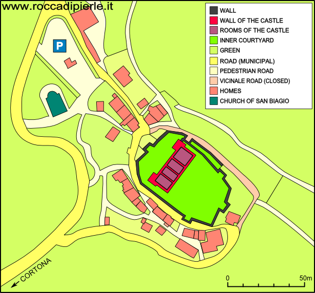
To better understand how Pierle is done, you should make use of the image below.
It shows a map of the borough and highlights the walls of the fortress.
Those who remain outside the walls, can hardly understand how the fortress is structured.
only within the walls, the visitor fully capture the magnificence of the castle.
The road that runs through the village of Pierle, touches only the west side of the fortress.
This road is always open and it is much lower than the level of the inner courtyards of the castle.
|
On the map you find the Church of San Biagio. It dates from the eleventh century and is located 100 meters from the castle.
Next to the church there is a parking lot. The castle is easily reachable on foot. |
 |
|
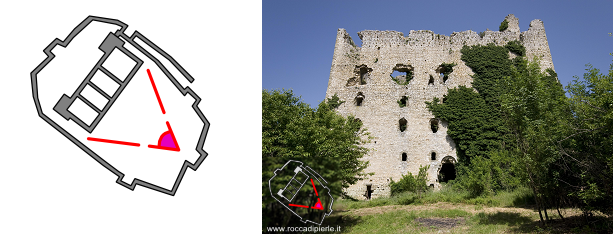
Example of a photo taken in 2009 from the courtyard and facing the south side of the castle. |
Last Update 03/08/2010
![]()
![]()
![]()